The 2023 edition of the Student Ideas Competition for the National Capital Region was launched during winter 2022. Participants had until the end of March 2023 to present their submission.
The Urban Design Challenge invited students from across Canada to come up with innovative design ideas for the Sussex Drive corridor situated in the heart of the National Capital Region.
The challenge
The competition focused on repairing and restitching the urban fabric. Students were asked to submit proposals that address vacant and under-utilized street lots where improvements from an urban design perspective could enhance the public experience through innovative planning and design ideas for the Sussex Drive corridor.

Team: Stephen Hickson, Arzen Chan and Christina Hoang
School: McGill University
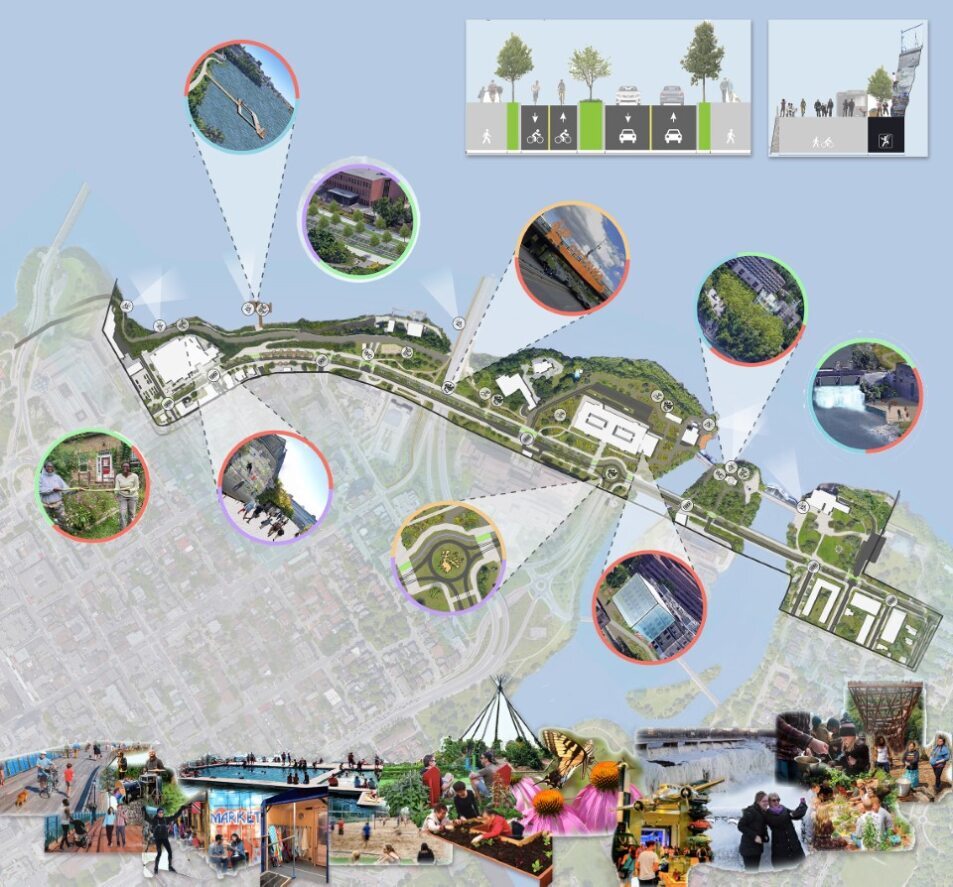
Rideau Connection
This design concept is guided by five themes: connection, animation, indigeneity, nature and water. Active transportation is at the heart of the plan and includes introducing new attractions which are connected to the existing urban fabric of the Sussex Drive corridor:
- Cliff Swallow Walk
- Museum dedicated to Canadian research
- Pollinator Garden
- Vista point at the foot of Rideau Falls
Team: Makenna Humes, Sara Wehbi and Homa Jalili Safarian
School: Queen’s University
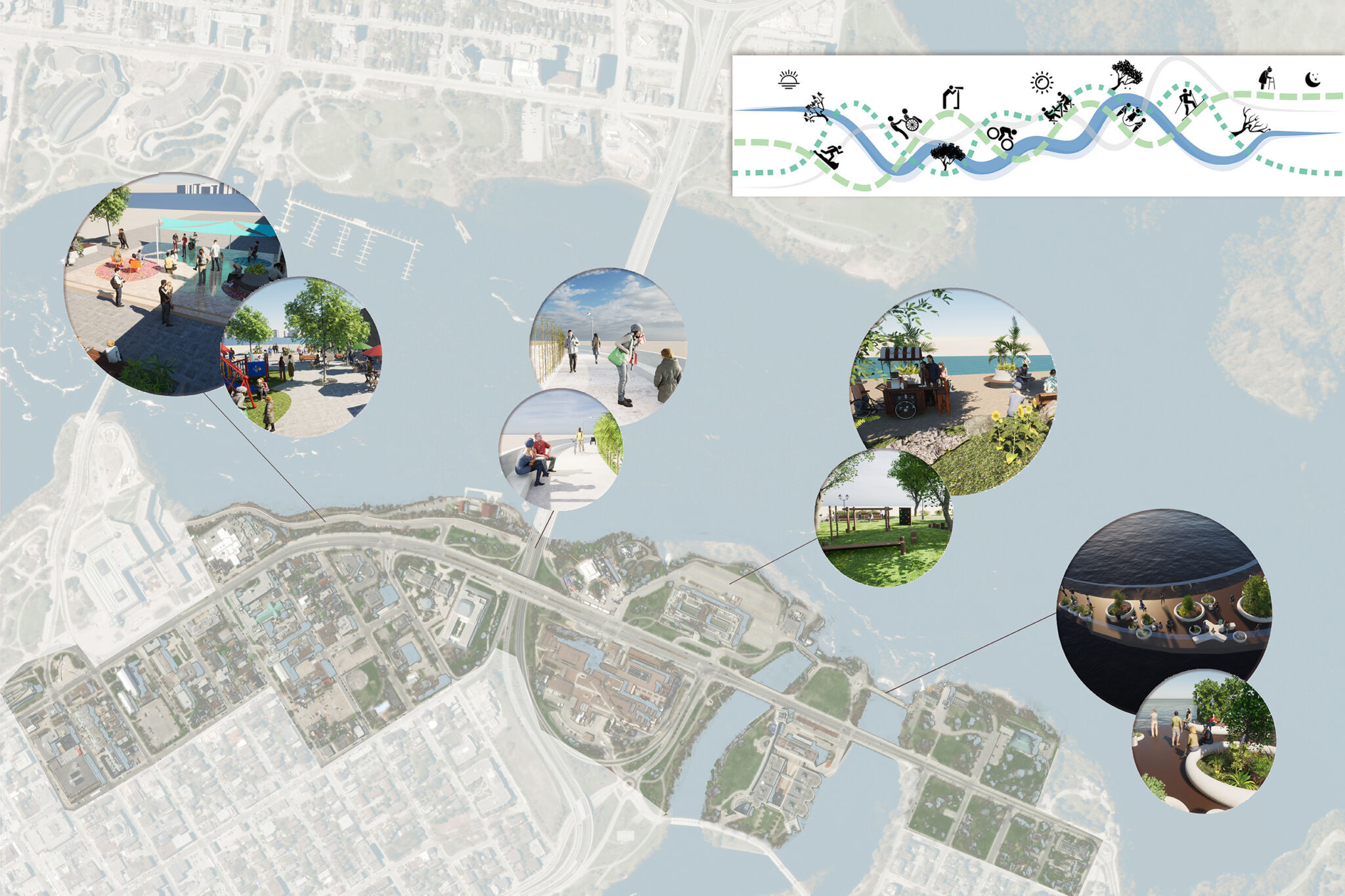
Animating Sussex Drive in the Core of Canada’s Capital
The design proposal focused on placemaking throughout the area, creating opportunities for active transportation, providing a welcoming space for Indigenous communities that represents their culture and improving waterfront access.
A jury of interdisciplinary planning, urbanism, design and site management professionals reviewed the submissions and selected the competition winners. The jury included:
- Monica Belliveau, RPP MCIP
- Thomas Saad
- Dorota Grudniewicz, OALA, CSLA
- Mazen Kandalaft, OAA, OAQ, LEED GA, MUP
- Kim Geoffrion
- Ian Grabina
- Nelson Edwards, OALA, RPP
- Traci Despatis
If you are interested in receiving updates about this Urbanism Lab event or future events, please sign up for the newsletter.
