Author: Bruce Devine, Senior Manager, Facilities and Programs
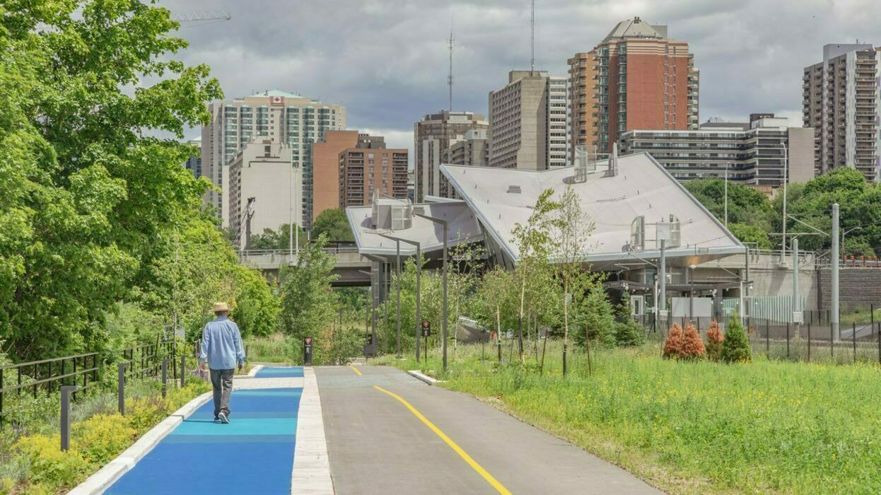
Have you heard of the LeBreton Flats Pathway? It is the first new pathway open since the adoption of the most recent Capital Pathway Strategic Plan. This pathway is partially divided into a cycling lane and a pedestrian lane — and it’s getting lots of reactions!
A lot of enthusiasts are asking for a similar concept to be implemented throughout the pathway network. But, is this the path forward for the Capital Pathway? Here’s the answer.
Two myths about the Capital Pathway
First of all, let’s look at two widely held false perceptions of the Capital Pathway.
The Capital Pathway is a recreational pathway network.
FALSE! Until 2020, we said that the Capital Pathway was a recreational pathway network. Our efforts were based primarily on recreation.
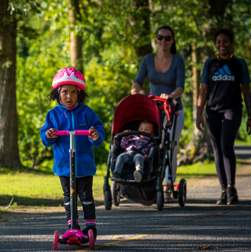
Today, we recognize that people’s reasons for getting around are varied: to go for a walk, to exercise, to discover the region, to commute to work and so on. And we recognize that these reasons are not mutually exclusive. The strategic plan is based on the experience of the people who use the pathway, regardless of their reason for using it.
Our vision? To make the Capital Pathway an exceptional pathway network where all can enjoy invigorating and inspiring experiences in the heart of magnificent Capital landscapes.
The Capital Pathway is a bike path.
FALSE! The Capital Pathway is a place that accommodates a wide spectrum of active mobility modes, including walking, jogging, in-line skating, cycling and use of motorized mobility aids. It is a shared and multi-use space, where everyone has a role to play to make the experience pleasant, safe and inclusive for all.
Sharing the paths is a challenge, and especially with the rising number of people who use the pathways, in all kinds of different ways. However, the strategic plan puts forward solutions:
- continue to educate the people who use the pathways;
- improve signage regarding the code of conduct; and
- design pathways that make sharing easier.
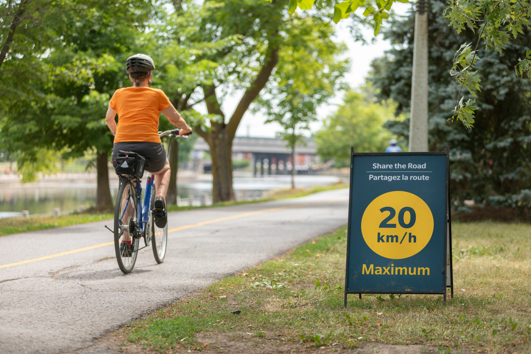
And, sometimes, designing pathways that make sharing easier means segregating the pathways.
To segregate or not to segregate?
Many people wonder if segregated pathways, like the one at LeBreton Flats, represent the future for the Capital Pathway. The short answer? Not entirely.
We plan to build segregated pathways and to segregate existing pathways where necessary, whenever possible. Multi-use pathways will continue to be the norm in the network, because they remain the most effective and cost-efficient pathway configuration.
Of course, there are many different elements to consider in the decision to segregate, or not to segregate, the pathways. The main considerations are available space, budget and environmental impact. The following are a few criteria that help guide our decision making.
Number of pathway visits
If there are too many people on the pathway at the same time, the lack of space affects the overall experience. For this reason, we are interested in the number of people using the pathway each day during the peak season, which is from April to September.
- Low capacity: 0 to 1,000 people/day
- Medium capacity: 1,000 to 2,000 people/day
- High capacity: Over 2,000 people/day
Low-capacity pathways do not need to be segregated. However, this is an option we are exploring, on a case-by-case basis, for medium- to high-capacity pathways.
To obtain usage numbers, we installed counters at specific points in the network.
Distribution by user type
More than 2,000 people per day, primarily on bikes, is fine. More than 2,000 people per day, when 50 percent of them are pedestrians, can cause bottlenecks, dangerous passing conditions and conflicts.
A person on a bike goes 6.6 times as fast as a person walking. On a bike, a person travels much greater distances in the same amount of time, often passing many people along the way.
We are prioritizing the segregation of pathways in areas where the proportion of pedestrians is higher, specifically near the following areas:
- densely populated areas;
- employment nodes;
- public transit stations; and
- tourist destinations.
Segregating pathways is one of a number of ways to create a clear and intuitive pathway-sharing environment. In cases where it is not possible to separate types of pathway use due to a lack of space, we will see if we can widen the pathway from 3 m to 4 m or 5 m, as stated in the plan. When necessary, we will also establish slow zones — particularly in areas where the pathway crosses a shared public space.
What’s next?
The next pathway that we will be working on is the Ottawa River Pathway, between LeBreton Flats and Mud Lake. This 9-km section will be subject to pilot tests aimed at segregating the pathway and creating places of interest along the Ottawa River South Shore Riverfront Park.
In this area, and as part of the second phase of the O-Train project, the City of Ottawa will fund the enhancement of 2.4 km of green space, including Westboro Beach. This work, which began in 2022, includes the separation of lanes for cyclists and pedestrians and the creation of a slow zone.
The ideal network, as presented in the Capital Pathway Strategic Plan, serves as a long-term road map for the evolution of the pathway network. If some aspects of our vision can be achieved in the 10-year horizon of this plan, other initiatives will be carried forward into future iterations of the plan.
