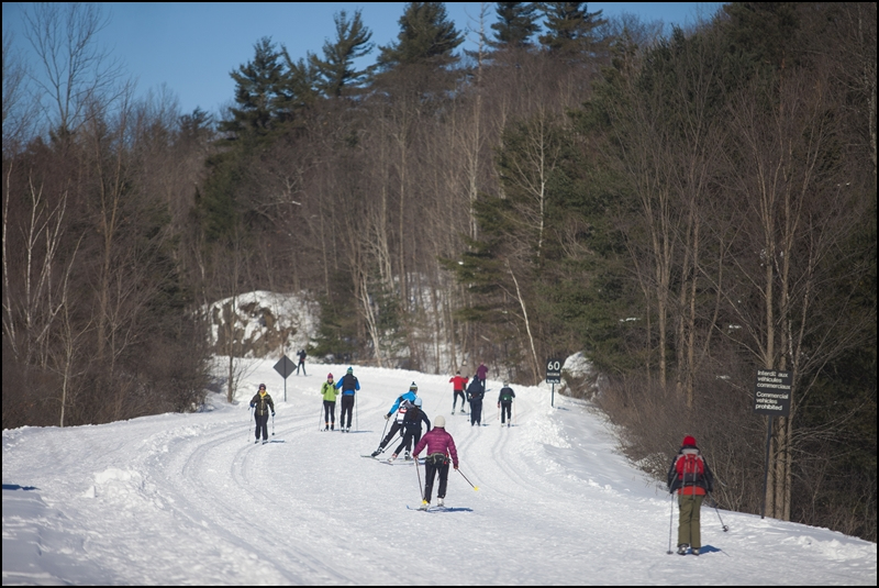
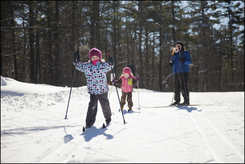
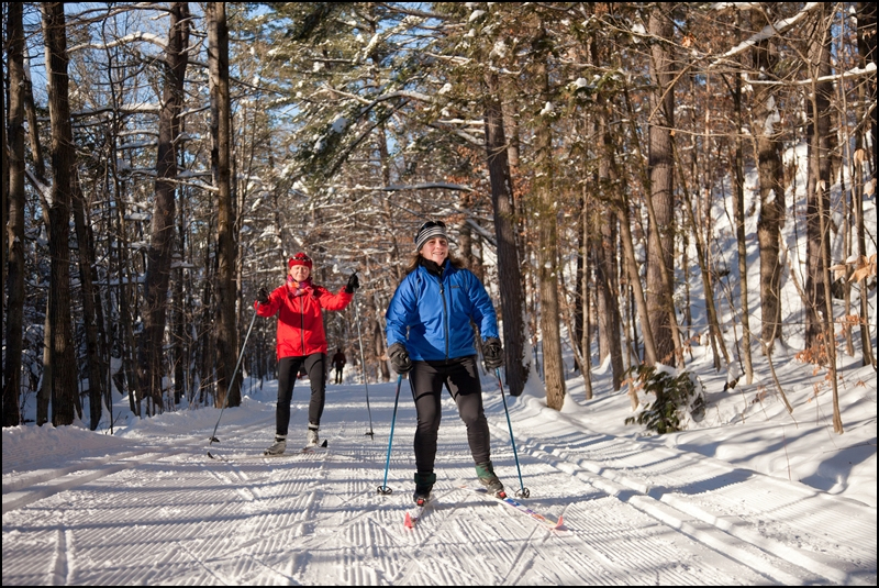
Gatineau Park has one of the largest networks of cross-country ski trails in North America. You will find over 50 trails, varying in difficulty (rated from easy to most difficult). Enjoy classic cross-country skiing and skate skiing in a beautiful conservation area, located just minutes from downtown Ottawa.
The Heart of the Network
P7 to Western
Technical Information
Start: P7 parking lot, Kingsmere Road, Chelsea
Total distance: 19 km (you can turn around at any point on this route)
Level of difficulty: Easy to intermediate
Technique: Classic or skate skiing
Route: Trails 30, 1 and 2; stop at Western Shelter; return via trails 2, 1B, Champlain Parkway, Fortune Parkway and 1
Note: The first 1.5 km includes a challenging climb.
- There are four shelters on this route: Keogan, Shilly Shally, Huron and Western. This loop trail in the heart of the network was developed by the Ottawa Ski Club in the early 20th century. People have been skiing in this area for over 100 years.
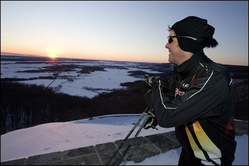
- Wattsford Lookout provides an exceptional view of the cities of Gatineau and Ottawa.
- Champlain Lookout offers an impressive view of the Ottawa Valley from a height of 300m, atop the Eardley Escarpment. The escarpment marks the junction where the Canadian Shield meets the St. Lawrence Lowlands.
- Did you know that, in Gatineau Park, white-tailed deer migrate to the Eardley Escarpment, where the snow cover is thinner? Viewed from above, the area reveals deer yards. These well-trodden paths are used repeatedly by deer to get around, helping them to save energy in the wintertime.
From the City to the Wilderness
Relais plein air du parc de la Gatineau to Pink Lake
Technical Information
Start: P2 parking lot, Relais plein air du parc de la Gatineau, 397 Cité-des-Jeunes Boulevard, Gatineau
Total distance: 12 km
Level of difficulty: Easy to intermediate
Technique: Classic
Route: Trails 29, 5, 15 and 35 to Pink Lake; return via the Gatineau Parkway, and trails 26 and 29 to Relais plein air du parc de la Gatineau
Note: The first half of this loop is a gradual uphill, which includes several steep climbs. The return includes a long, but easy, downhill section on the Gatineau Parkway from Pink Lake.
- The Relais plein air du parc de la Gatineau is a great place to start and finish a day of skiing. The building, operated by a not-for-profit organization, offers warm shelter, washroom facilities and a waxing room.
- This loop features a variety of scenery and terrain, including open fields and a gently rolling trail that winds through mature forests. The route also covers sections of trail that are used for the Gatineau Loppet, Canada’s largest cross-country ski event.
- The end of trail 35 provides a view of beautiful Pink Lake. This exceptional lake is classified as meromictic, which means that, because of its sheltered position and bowllike shape, the water layers of the lake do not mix. The result is that the deepest 7 metres of the lake contain no oxygen.
A Prime Minister’s Backyard
Mackenzie King Estate to Pink Lake
Technical Information
Start: P6 parking lot, Mackenzie King Estate, Barnes Road, accessible from Chelsea
Total distance: 8 km
Level of difficulty: Intermediate
Technique: Classic
Route: Trail 7, then along the Gatineau Parkway to trail 35 at Pink Lake; return via trails 35 and 15
Note: This route runs primarily downhill from the beginning to Pink Lake, and is mostly uphill on the return. There is one big climb near the end of the loop.
- P6 parking lot is at the heart of the Mackenzie King Estate. This was the summer home of William Lyon Mackenzie King, Canada’s longest-serving prime minister, who was in office for close to 22 years, between 1921 and 1948.
- As you leave on Trail 7, you will pass the Abbey Ruins, arguably the most famous set of architectural ruins that Mackenzie King assembled to landscape his garden.
- The beginning of Trail 35 provides a view of beautiful Pink Lake. This exceptional lake is classified as meromictic, which means that, because of its sheltered position and bowllike shape, the water layers of the lake do not mix. The result is that the deepest 7 metres of the lake contain no oxygen.
- Trail 15, which you will follow for most of the way back, is a particularly scenic trail that winds its way through mature forests and rolling hills for about 3 km.
Paths of the Early Settlers
Wakefield to Herridge
Technical Information
Start: P17 parking lot, Highway 105, La Pêche
Total distance: 20.4 km
Level of difficulty: Intermediate
Technique: Classic
Route: Trails 52 and 50 to Herridge Shelter for a rest stop; return via the same trails
Note: This route involves several long and sustained climbs on Trail 52. On the way back, these become fairly long and fast downhill sections.
- Trail 52 is an exceptionally beautiful, classic-style-only trail, which passes through a magnificent forest of majestic pines, enormous hemlock trees and a few beech groves.
- The rest stop, Herridge Shelter, is an original settler’s house which was built in the late 19th century. It has been completely restored so that it can be used every day in the winter by skiers and snowshoers. There’s always lots of activity at the bird feeders just a few steps from the shelter, which are very popular with birds that overwinter in the Park.
- This route is part of the Trans Canada Trail, which runs through the Park for a distance of 35 km from Gatineau to La Pêche (Wakefield).
More Information
The NCC is the federal Crown corporation dedicated to ensuring that Canada’s Capital is a dynamic and inspiring source of pride for all Canadians, and a legacy for generations to come. The text, media and mapping data presented within this application are subject to the NCC’s Important Notices and Disclaimer.