Confidently explore Gatineau Park using our trail maps. The maps show the official trail network for every season.
All official trails are marked, safe and secure, and well-maintained, both for your safety and for the long-term sustainability of our ecosystem. Staying on official trails helps reduce habitat fragmentation and protects the conservation park’s ecosystems.
Carry a paper map of the trails or use your phone to find your route, even when there’s no cellphone signal reception!
Gatineau Park trail network maps
Paper maps
Gatineau Park paper maps are on sale at these locations:
- Relais plein air (397 Boulevard de la Cité-des-Jeunes, Gatineau)
- Gatineau Park Visitor Centre (33, Scott Road, Chelsea)
- World of Maps (1191 Wellington St. W, Ottawa, ON K1Y 2Z6)
Georeferenced maps
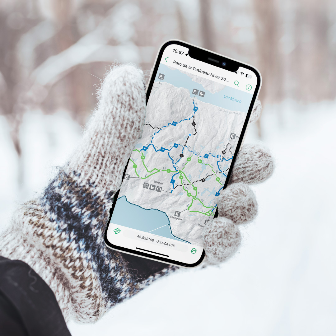
The Gatineau Park official trail maps are now georeferenced and available for free through the mobile app Avenza Maps. Using your phone, you can now track your position in the Park at any time, even if there is no cellular signal.
- Step 1: If you don't already have it, download the mobile app Avenza Maps on your device (via the App Store® or Google Play StoreTM).
- Step 2: In the app Map Store, download the map of your choice before your outing.
Winter | Activity-specific interactive maps
During the winter season, we update the following interactive maps regularly. Use them to learn about the conditions and plan your outing.
PDF maps
Gatineau Park maps are available for free in PDF format. Download them below.
Documents
- Gatineau Park Winter Trails Map (23.54 MiB)
- Gatineau Park Winter Camping Map (22.61 MiB)
- Gatineau Park General Winter Map (10.68 MiB)
- Gatineau Park Summer Trails Map (12.72 MiB)
- Summer camping map - La Pêche Lake (492.16 KiB)
- Summer camping map - Taylor Lake (512.98 KiB)